
Illustration of Torres Strait

Australia · Horn Island, Far North Queensland

Torres Strait webcams.

Torres Strait webcams: Airservices Australia's weather cameras at Horn Island Airport, the gateway to Thursday Island, with current weather.

Torres Strait has 3 camera views on this page, published by Airservices Australia.

Camera 1 of 3

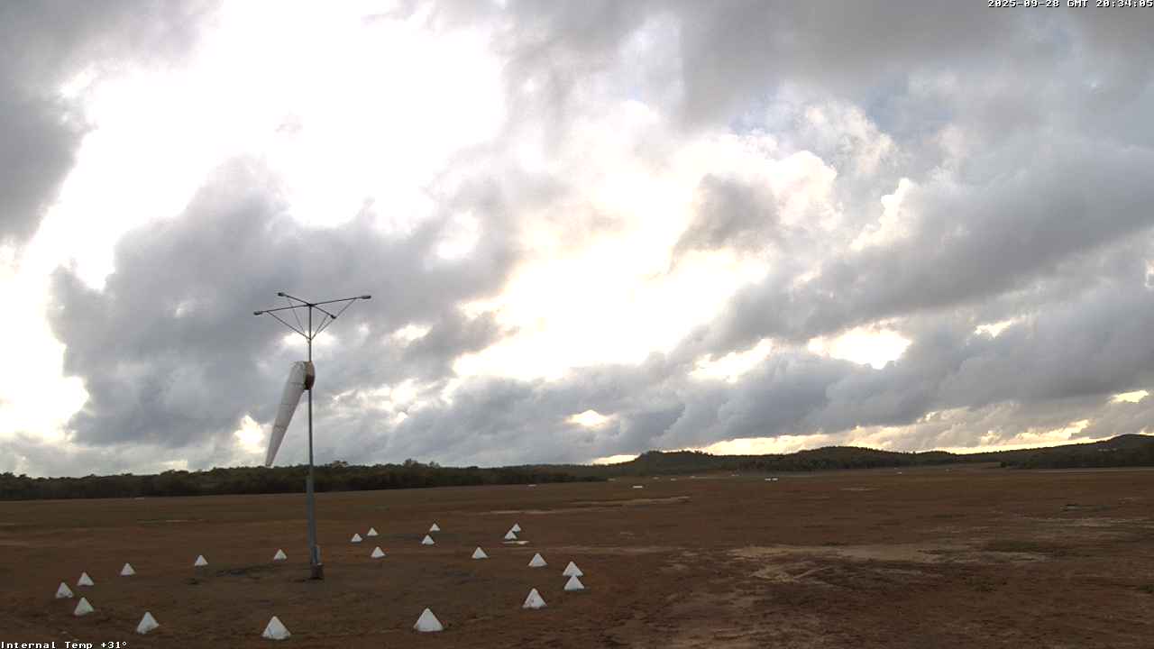
Torres Strait - Airport looking east

Still image · reloads every 90 sView at source
Latest live camera view: Torres Strait - Airport looking eastCamera image · Reloads every 90 seconds

The view east over the weather instruments to low hills, facing the sunrise. Airservices Australia

3 cameras at Torres Strait

Plan your visit

Torres Strait at a glance

What to expect, when to go and what to look for on the live view. Check official local information before you make plans.

Best for
Tropical skies over the islands at the northern tip of Queensland
Best time to watch
Dry season from May to November, with steady trade winds; the wet season runs from December to April
Watch for
Pink cloud at sunrise, trade-wind cumulus through the dry season, monsoon squalls in the wet and bushfire smoke late in the year
Location
Horn Island, Far North Queensland, Australia
Coordinates
-10.5864, 142.2900
Cameras
4 views
Published by
Airservices Australia
Official site
torres.qld.gov.au
Listings last reviewed

Torres Strait webcams: what each camera shows

  1. Torres Strait - Airport looking east

    The view east over the weather instruments to low hills, facing the sunrise.

    Still image, refreshed by the publisher · Airservices Australia

  2. Torres Strait - Airport looking south

    The dry grass of the airfield and a low wooded ridge to the south.

    Still image, refreshed by the publisher · Airservices Australia

  3. Torres Strait - Airport looking west

    The edge of the airfield and a line of tropical woodland to the west.

    Still image, refreshed by the publisher · Airservices Australia

  4. Torres Strait - Airservices weather cameras

    The official camera page for Horn Island Airport, with every view and the time of each image.

    Opens on the publisher's site · Airservices Australia

All cameras: view at Airservices Australia

About Torres Strait

The Torres Strait Islands lie between the tip of Cape York in Queensland and Papua New Guinea. Horn Island, or Ngurupai, has the main airport, and passengers cross by ferry to Thursday Island, the administrative centre, a few kilometres away. These Torres Strait webcams are aviation weather cameras run by Airservices Australia at Horn Island Airport.

Which Torres Strait webcam to check first

Open the east view first: it looks over the instrument enclosure to low hills and catches the sunrise. The south view runs across the dry airfield to a wooded ridge, and the west view faces a wall of tropical woodland. The images are stamped in GMT, ten hours behind local time.

Before you go to Torres Strait

Monsoon weather can disrupt flights and ferries between December and April. Check the Bureau of Meteorology's Thursday Island forecast before you travel.

About live views

Live cameras and modelled weather can be delayed, incomplete or offline. Check official weather, access and safety information before you make plans.